The earliest known map depicting Jerusalem the Madaba map (c. 565), a mosaic on the floor of a Byzantine church in modern day Madaba, Jordan. Maps of the Holy Land during the Middle Ages were mostly made by Christians and were more symbolic than geographical, seemingly trying to connect Jerusalem across space and time to Biblical events. The printing press allowed for larger and more detailed maps to the published and circulated, such as the first modern atlas published by Abraham Ortelius in the sixteenth century. The first map to be published with the printing press was by Lucas Brandis in 1475, included in an encyclopedia about Christianity. Even after the advent of printing, map makers often drew from manuscript sources and sought to visualize historical periods, especially associated with the Frist Jewish Temple and the ancient Roman Empire.
Maps made by Christians in various periods often ignored the presence of Muslims and Islamic history. For example, Matthaeus Seutter’s eighteenth-century map of Palestine combines both geography and history, depicting the area from the time of the First Temple to the Roman period. While less common, maps by Jews were also created and circulated. These Jewish maps were often inspired by Christian maps, including history significant to the Jewish faith. Shlomo of Helm (1717-1781), a Jewish scholar and rabbi, created a map of Israel divided among the Twelve Tribes of Israel. Much later, Schottlaender printed a lithograph of Jerusalem in Breslau, c. 1900. He included significant holy sites and the newly established Jewish colonies settled by the Zionist movement.
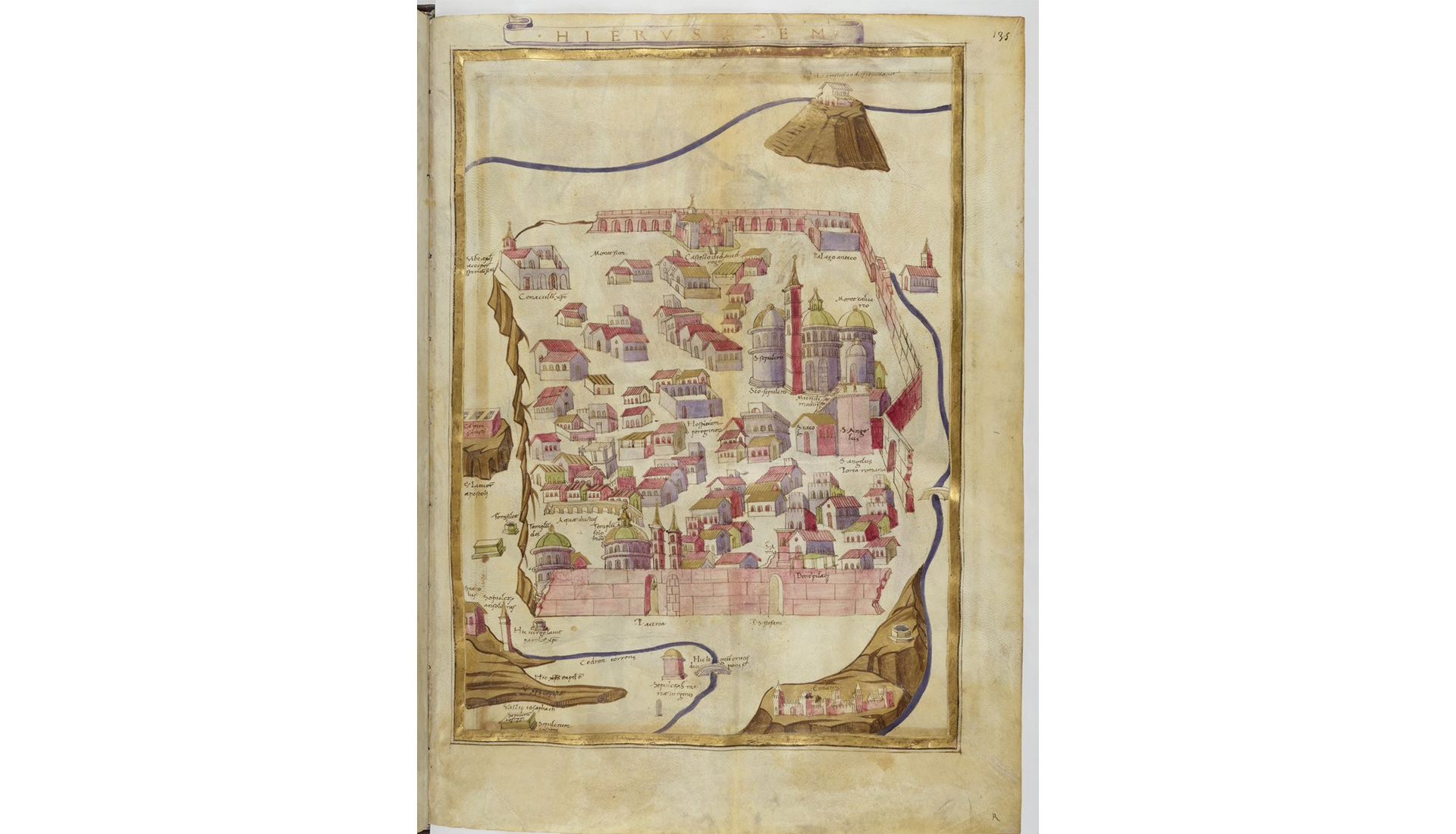
Jerusalem, from Claudius Ptolomaeus, Cosmographia / Cosmography (Ms. Lat. 4802, fol. 135, National Library of France), 1472
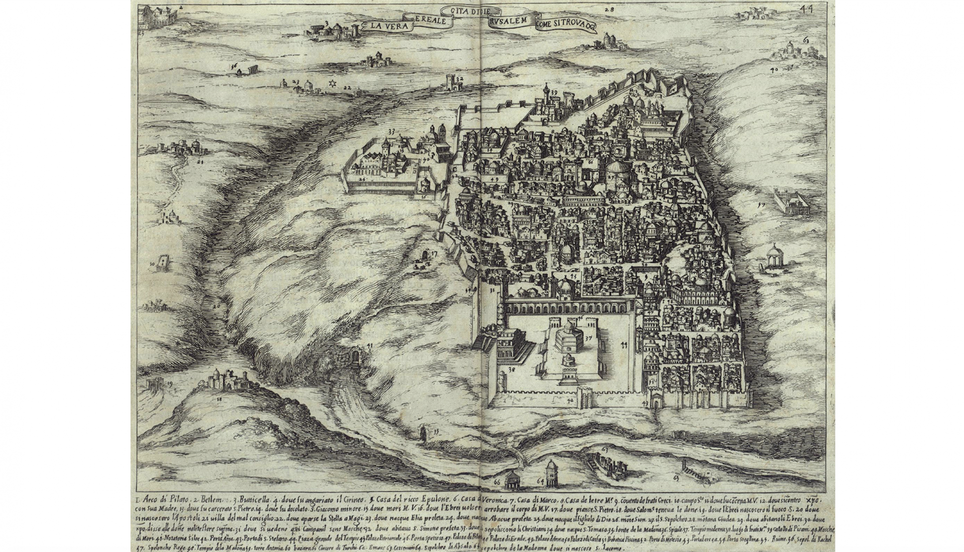
Modern Jerusalem, from Bernardino Amico, Trattato delle Piante & Immagini de Sacri Edifizi di Terra Santa… / Treatise on the Plans and Images of the Sacred Buildings of the Holy Land (Florence, 1620)
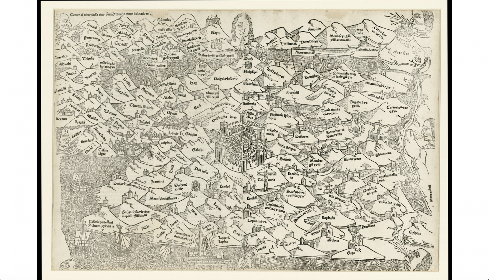
Palestine, from Lucas Brandis, Rudimentum Novitiorum / A Handbook for Beginners (Lübeck, 1475)
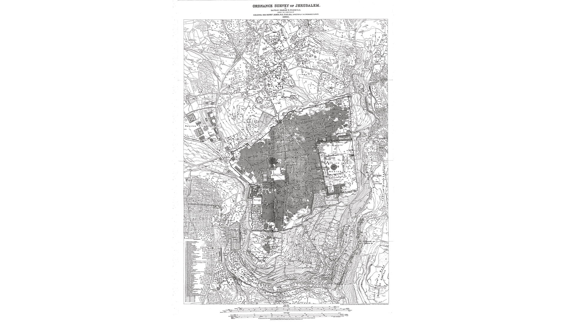
Ordnance Survey of Jerusalem by Charles Wilson, 1864-65
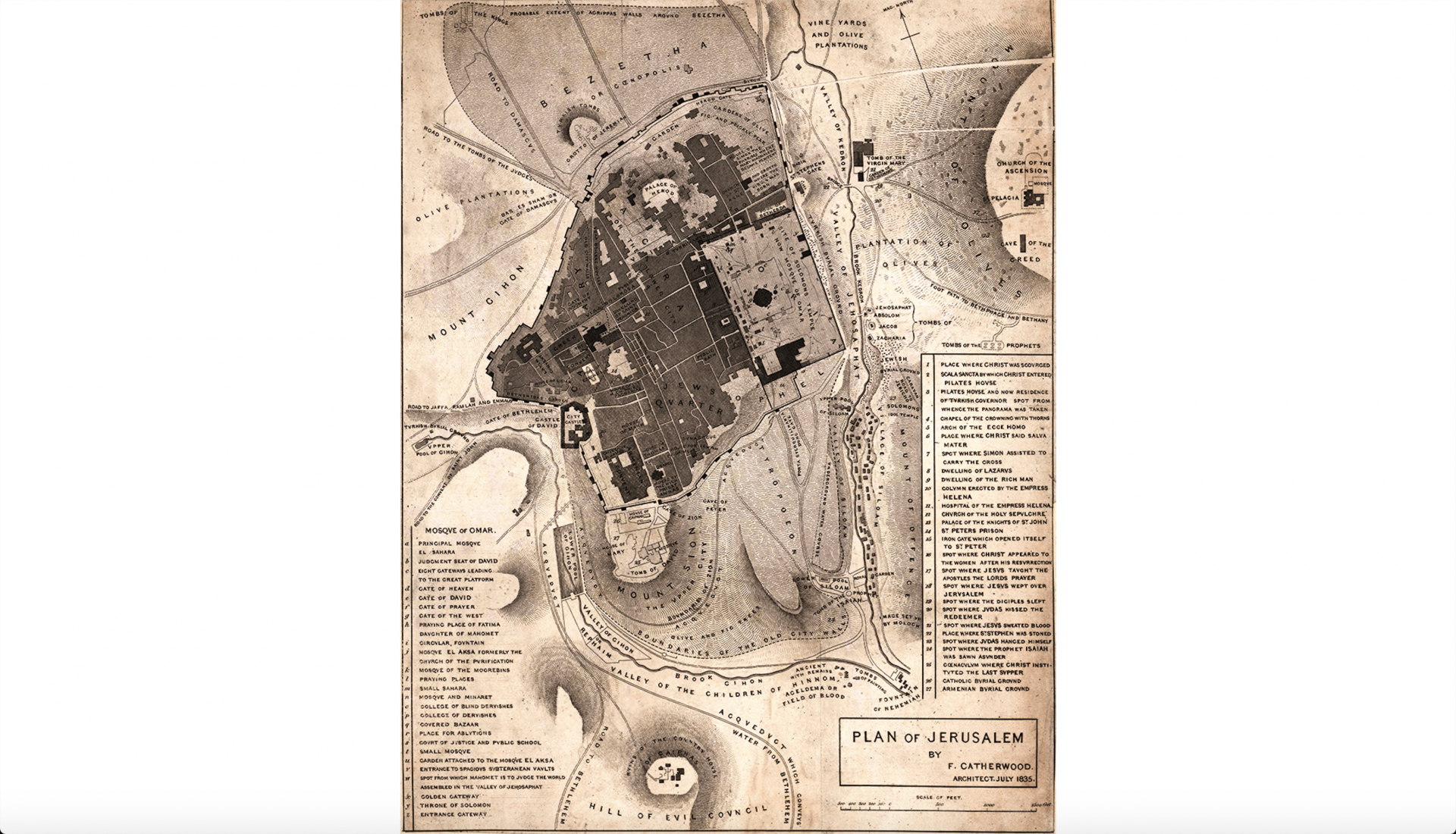
Jerusalem by Frederick Catherwood, 1835
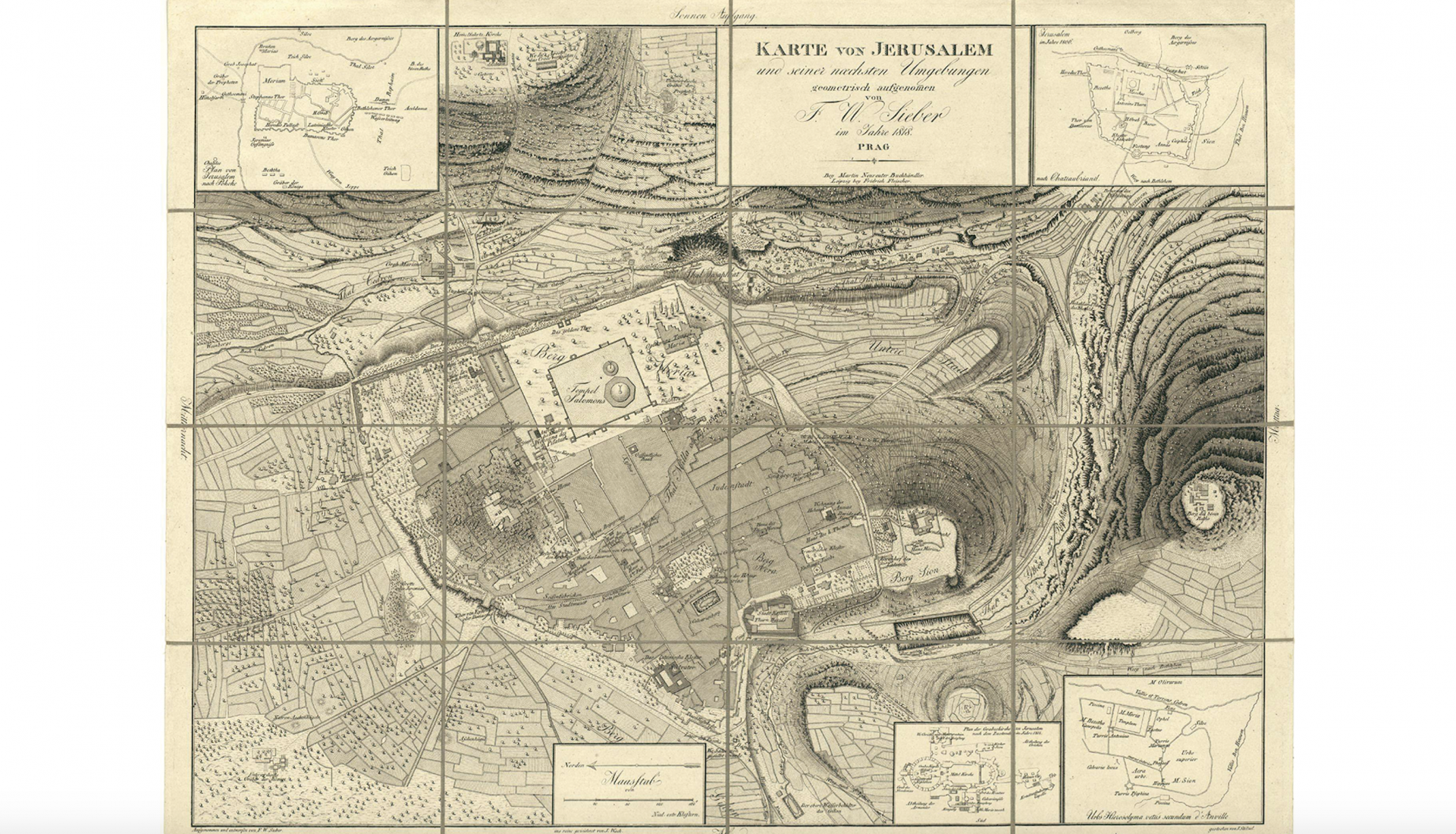
Jerusalem, from Franz Sieber, Karte von Jerusalem und seiner naechsten Umgebungen / Map of Jerusalem and its environs, 1818
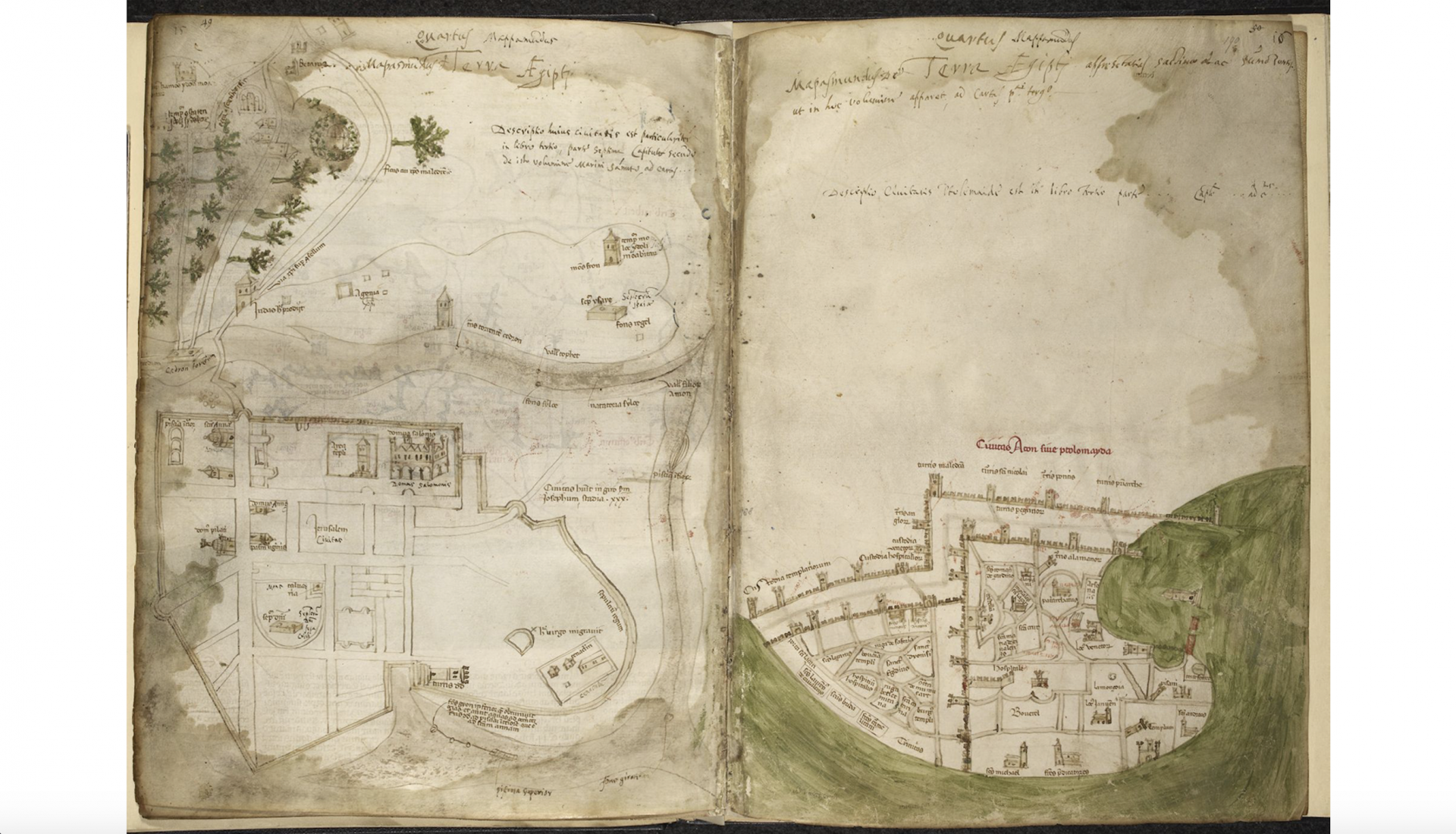
The Holy Land, from Marino Sanudo, Liber secretorum fidelium crucis / The book of secrets for faithful crusaders (Add. Ms. 26376, fol. 189v, The British Library), c. 1320-25
Jerusalem (Ms. 76 F 5, The National Library of the Netherlands), c. 1200
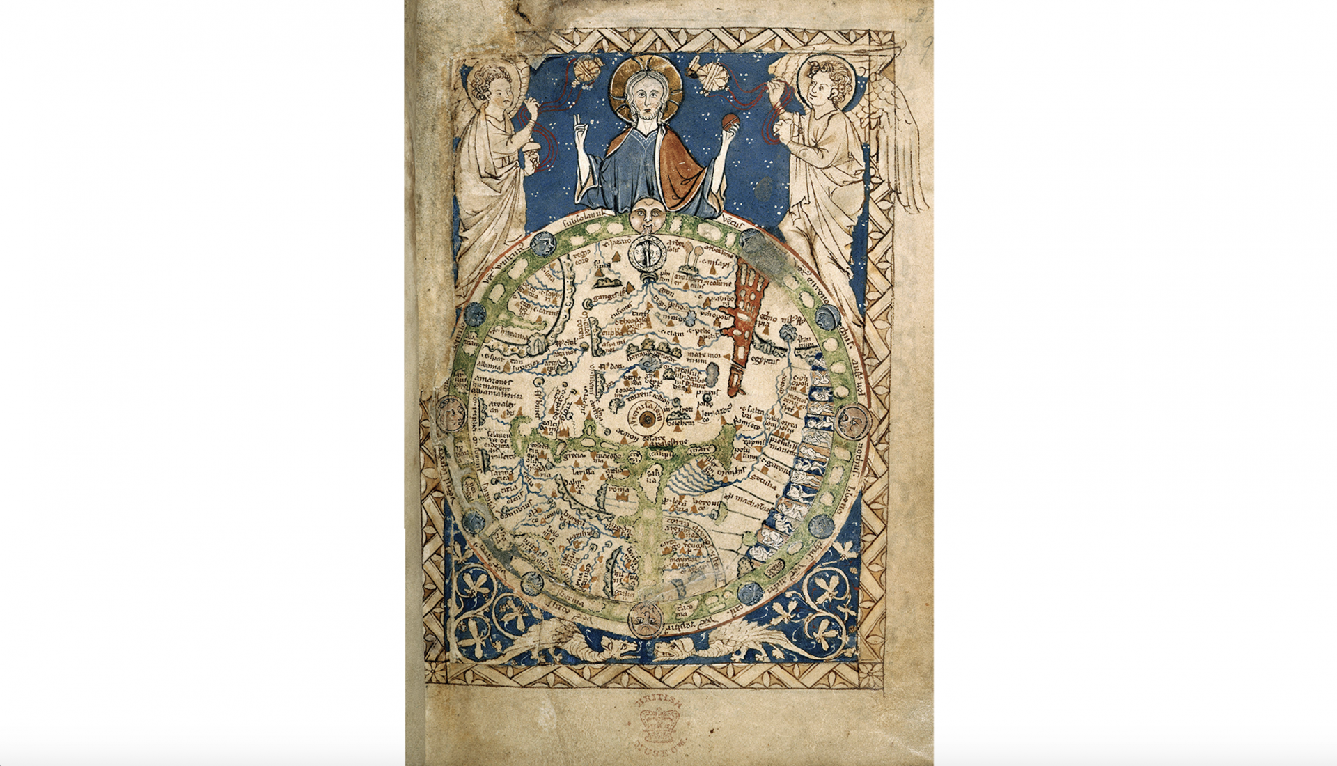
Jerusalem (Add. Ms. 28681, fol. 9r, The British Library), c. 1260
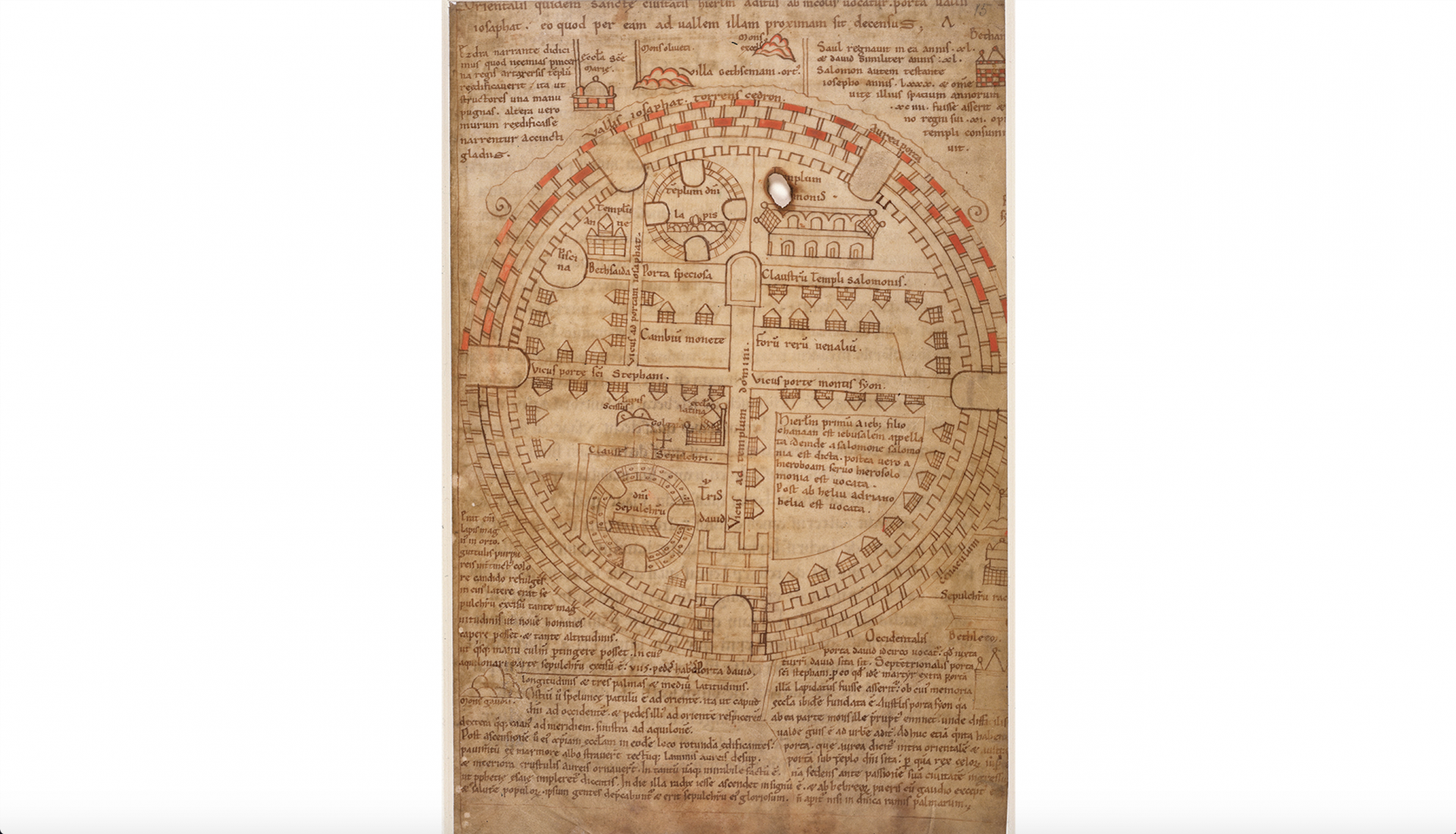
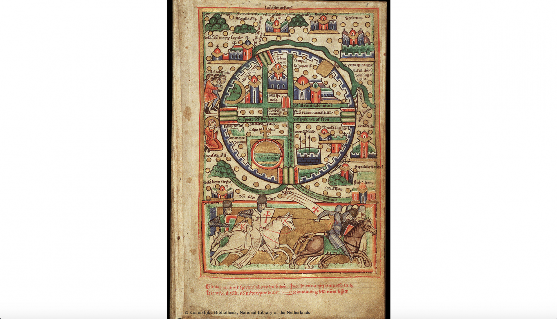
Jerusalem (Add. Ms. 32343, fol. 15r, The British Library), c. 1150
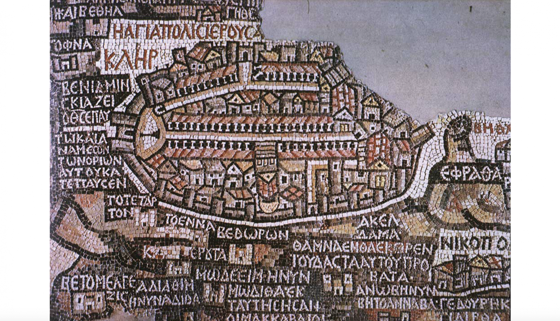
Madaba Mosaic (Church of Saint George, Madaba, Jordan), c. 685